Northern California
The Northern Sierras and Southern Cascades
We’re starting our trip close to home. We’ve spent a good amount of time in the Sierras and Central Coast, but haven’t ventured much farther north. We could spend a lifetime here and not run out of land to explore.
Downieville
A former gold rush town, Downieville (population 159 as of 2019) is now famous for a different kind of rush. The town is a destination for mountain bikers, with shuttles for those who want to skip the grueling uphill climb and just get to the fun part. These trails are well beyond my skill level, but I hear from Lee and other experienced bikers that they can’t be missed.
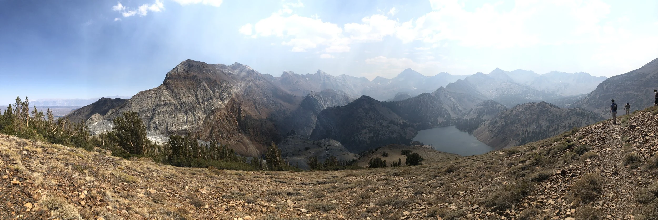
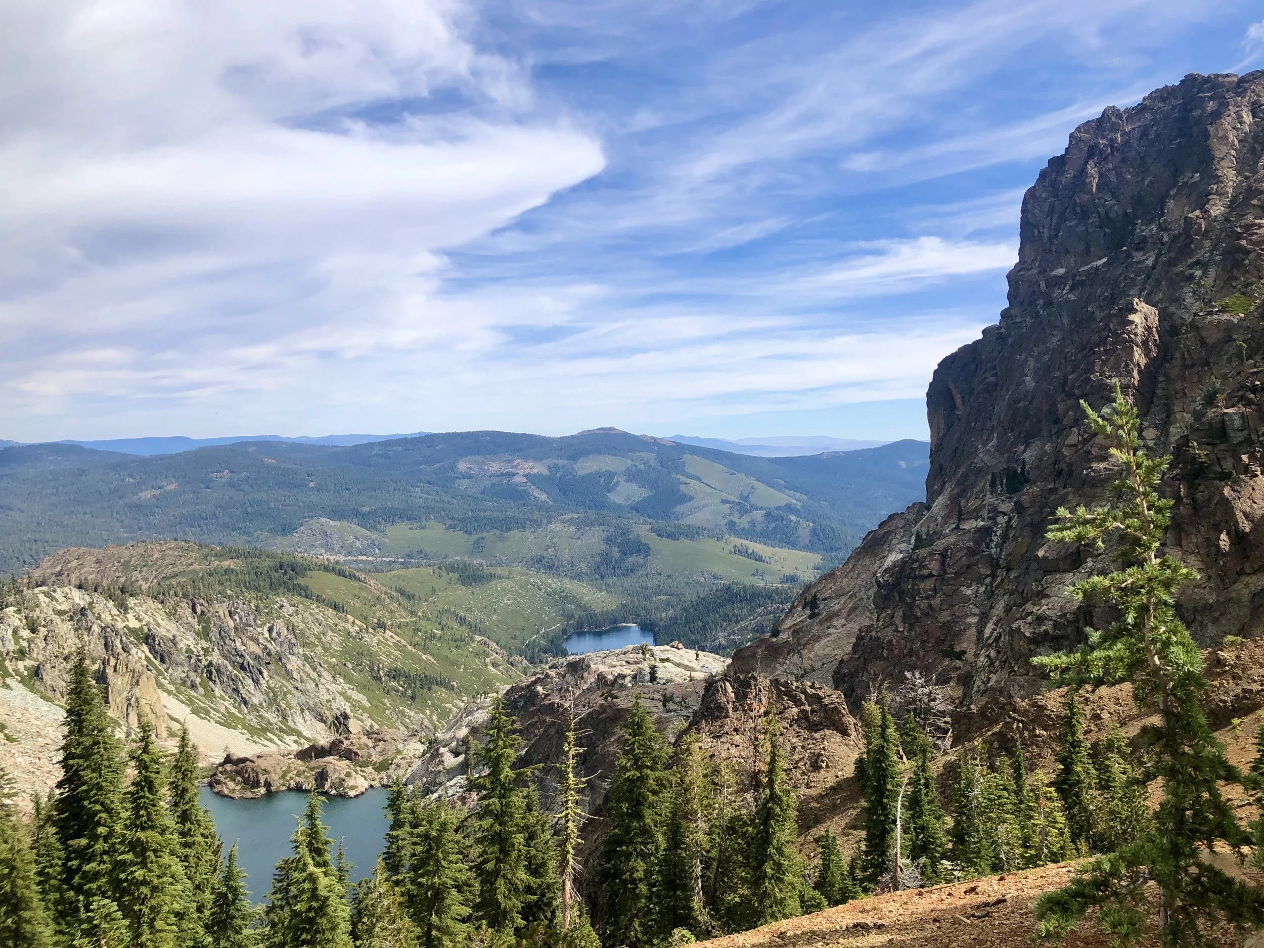
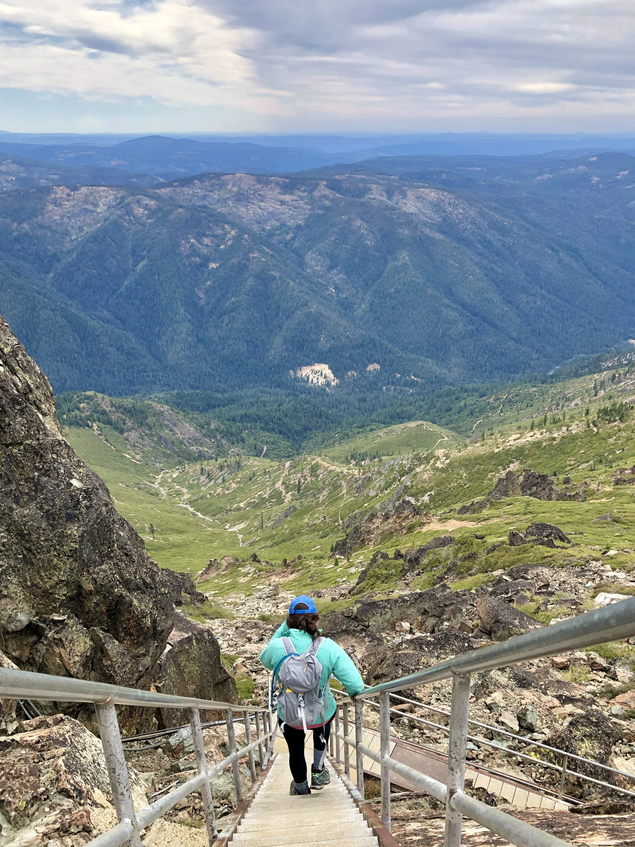
For those less daring, Downieville’s location at the confluence of the Downie River and North Yuba River provides plenty of other recreation options, including rafting, swimming, fishing, and hiking. Walk for a couple miles along one of the rivers and you’re likely to stumble across old mining cabins in various states of decay and signs threatening visitors against panning for gold. The surrounding forest has hundreds of hiking trails at all levels of difficulty; I particularly enjoyed the Sierra Buttes Lookout Trail, a short (<5 miles) but strenuous, out-and-back hike that takes you to the top of the Sierra Buttes with stunning views of the surrounding mountains.
Camping nearby is plentiful; Downieville is in the middle of Tahoe National Forest with miles of forest roads for dispersed camping. Some spots are scoped out already on iOverlander and the Dyrt, but we have always ended up finding our own once we got here.
We’ve been here in peak season (early September) and right before the season starts (early May), and the difference was striking; the small downtown area was packed with people in September, and the shops were bustling. May, despite being only a couple weeks before the official season started, was deserted; most of the stores and cafes were closed, and the streets were empty except for a few locals going about their business. Fortunately, St. Charles Place, a charming historic saloon, is open year-round, as is Two Rivers Cafe, so you can find food and drink even in the off-season. Downieville Outfitters caters to its audience well, providing shuttle service, bike repairs, gear, and a restaurant/tap room.
View from the hike up the Sierra Buttes.
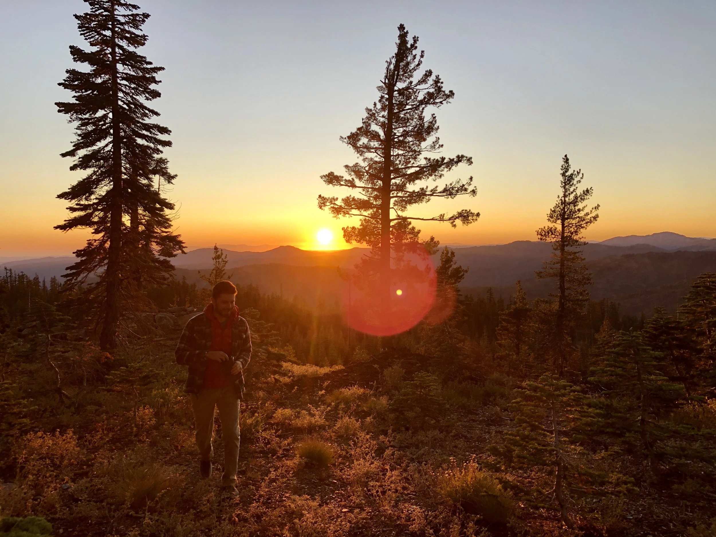
Sunset from our campsite the first time we came to Downieville; we came in the busy season, so we drove a couple thousand feet up from town to find more solitude.
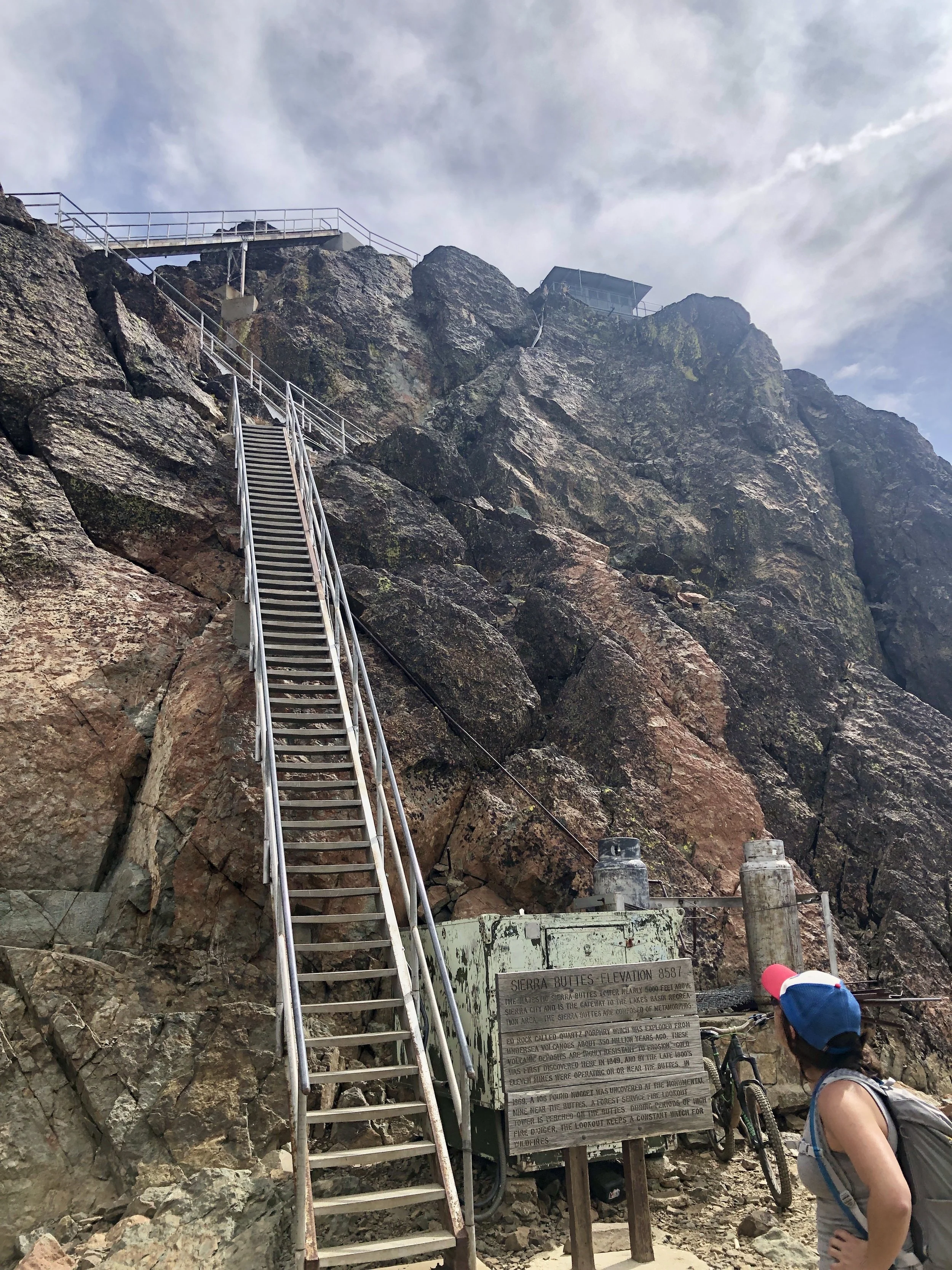
The last bit of the Sierra Buttes hike to the lookout/weather station; some of these stairs span gaps in the rock with thousand+ foot drops below, so I do not recommend if you're afraid of heights!
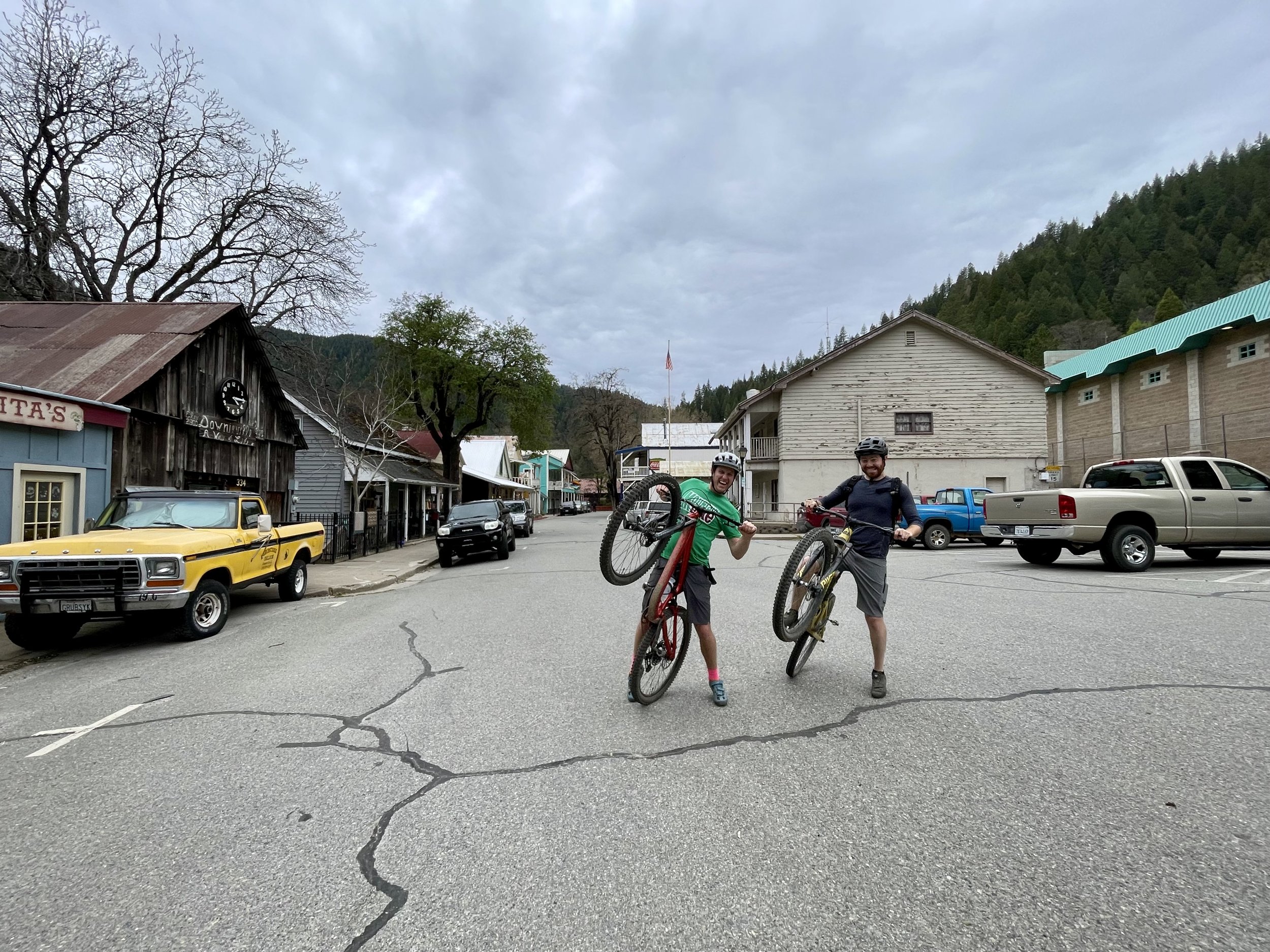
Two Downieville downhillers goonin' it up downtown.
Hiking down from the top of the Buttes.

Signs like this pepper trails near the rivers. This sign looked fairly recent, others were worn almost to the point of illegibility.

Campsite on our second visit to Downieville; turnouts like this are all over forest roads.
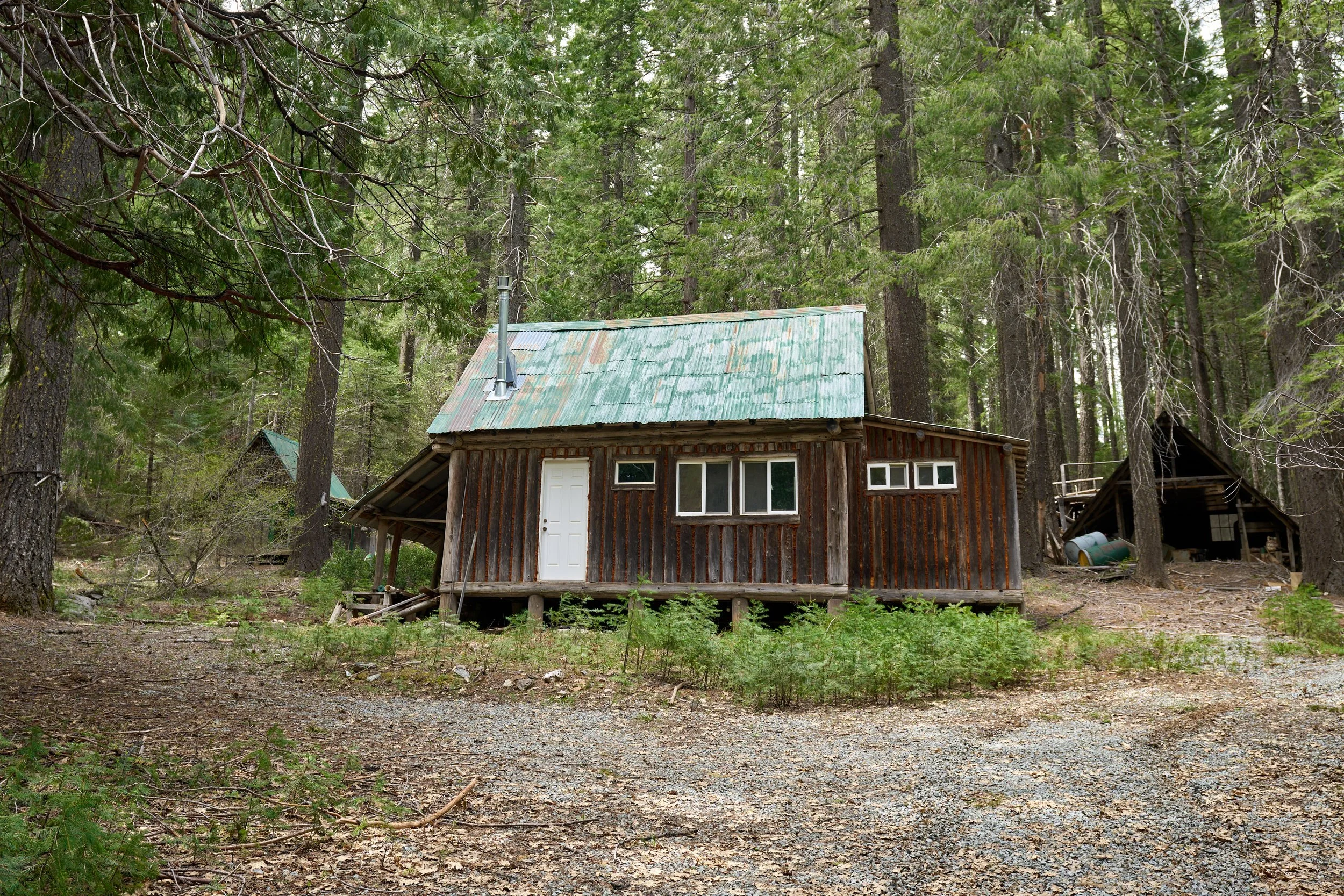
A questionably abandoned mining shack near the river. It didn't look inhabited, but the door and windows looked new enough that I kept my distance, lest some shirtless man in overalls come out with a shotgun.
We’ve wanted to go to Mount Shasta for years; it is about a five-hour drive from the Bay Area, so plenty close for a long weekend, but we just never made it. We risked coming here early in May, especially with a questionably wet and cold forecast, and ended up regretting that choice. Our intended campsite had a large tree blocking the road, it snowed the first night we were there, and the weather the following nights threatened overnight lows in the teens.
All that to say, we didn’t spend nearly as much time as we wanted here, and we’re looking forward to coming back in a few weeks to a (hopefully) warmer welcome.
The clouds covered Shasta’s peak the entire time we were here, so we never got a full glimpse of the volcano, but she did show us little peeks (pun intended) of her snow-covered sides. Before leaving, we squeezed in a quick hike; we noticed that there were mountain bike trails near our campsite down a random forest road, so followed these up to an established loop that passed through our intended campsite. There is a whole network of bike trails on Shasta that aren’t on AllTrails, Trailforks, or any other apps. They are clearly maintained and labeled, so it appears that these are for the locals and those willing to go off the beaten path.
The town of Mount Shasta has (presumably, sans clouds) beautiful views of the mountain with plenty of cafes, bars, and stores to refill and refuel. Our cell service up here was surprisingly strong, which was fortunate because we forgot to download offline maps and the trail we were trying to follow was completely submerged in snow and we lost our way multiple times.
Mount Shasta

This was our intended camping area; a tree blocked our vehicle's access, but we crawled under it to hike into the area. Despite the clouds, the view did not disappoint! This area is probably overrun in warmer months, but we hope to camp here in the future.

Views of Mount Eddy from our campsite.

Mount Eddy, but cloudier. PC: Lee

While the weather was suboptimal for camping, it was ideal for hiking.

We found rock circles of varying sizes scattered over the camping areas on Shasta. Some were 100' wide, others smaller. Aliens? Most definitely.

The tree that blocked us from our campsite :shakes fist:

There were no sightings of the owner of this impressive paw print, fortunately!
Volcanic Legacy Scenic Byway + Drive to Oregon
We love a scenic drive, so when Lee spotted the Volcanic Legacy Scenic Byway on a map, we prioritized making this part of our route north to Oregon. As its name implies, the byway passes through multiple volcanically formed areas. To be honest, everything in Northern California is so scenic that we probably wouldn’t have even noticed if we didn’t seek the route out intentionally. I wouldn’t say it’s a destination in and of itself, but between driving this or the 5, we’re glad to have tacked an extra 45 minutes onto our journey for the more scenic route.
We drove from Downieville up to Mount Shasta then on to Bend, Oregon. The road passes through multiple old mining towns like Greagle and Quincy. Many of these, like Downieville, play up their gold rush roots and maintain the characteristic architecture of the old west, with false front stores, log cabins, and saloons.
It’s typical to see burn scars when driving through California. Fire plays an important ecological role in California and Indigenous people managed the forest and its natural fire season for millennia. Fire adds rich nutrients to the soil, clears space for new growth, and California’s great trees, the redwood and sequoia, actually need fire in order to reproduce. However, climate change, population growth in the rural-urban interface, crumbling PG&E power infrastructure, human negligence (yes, including gender reveal parties, but more often cigarette butts and illegal fires), and excessive fire suppression at both the federal and state level have all led to a dramatic increase in sparks, fuel, and intensity in the past decade. The burn scars are becoming larger and more severe, and as we headed north, we spent an hour driving through a forest of blackened, splintered sticks. I hadn’t realized where we were on a map until we passed through Greenville, another historic mining town that was wiped out in a mere 30 minutes when the Dixie fire raged through.
The Dixie fire is the largest single wildfire in California history, and burned nearly a million acres (an area larger than the state of Rhode Island) over more than three months in July - October 2021. It was also the first fire in recorded history to burn across the crest of the Sierras, whose rocky peaks sit above the tree line, providing a natural barrier. It’s been nine months since Greenville was destroyed; several homes far from the town’s center were spared, but the downtown area was reduced to charred rubble. Trailers and construction equipment were scattered throughout town amid blackened shells of cars, crumbled foundations, and signs advertising aid and shelter. Many towns like Greenville have been consumed by wildfires in recent years, and even the fire-resistant redwoods and sequoias, some of the oldest trees on the planet that have survived thousands of natural fire seasons, are succumbing to the increasing power of modern wildfire. As we passed into greener, unscathed areas of Northern California and southern Oregon, signs alerting people of fire prevention were still posted everywhere. One of the main reasons Lee and I wish to move away from California is the risk of fire, and at risk of sounding corny, I found some symbolism in leaving the burnt landscape behind us as we traveled out of the state.

Remnants of trees burned by the Dixie Fire in Plumas National Forest.

Remnants of trees burned by the Dixie Fire in Plumas National Forest. This was a rare spot where the tops of trees still shone green; many species of California pines are fire-resistant, having evolved to survive the natural cycles of forest fires.

A charred but still-standing building on the outskirts of Greenville, CA.

Upper Lake Klamath welcomed us into Oregon.